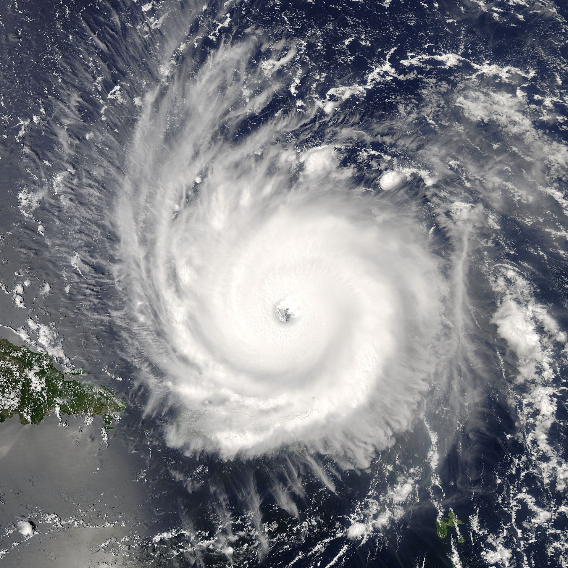
Hurricane History of Brevard County
Major storm hits on Brevard: 1926, 1933, 1947, 1979 (David), 2004 (Frances and Jeanne), 2016 (Matthew), 2017 (Irma). The Atlantic coast of Florida runs lighter than the Gulf, but each storm rewrites the coastline.
Brevard County sits on the Atlantic coast of Florida, where major hurricane strikes are less frequent than on the Gulf coast but rare years are not the norm either. The county has taken at least seven significant hurricane events since 1900. The biggest were the 1947 Fort Lauderdale Hurricane (close pass), Hurricane Frances and Hurricane Jeanne in September 2004 (back-to-back direct hits), and Hurricane Matthew in October 2016 (close pass with major surge).
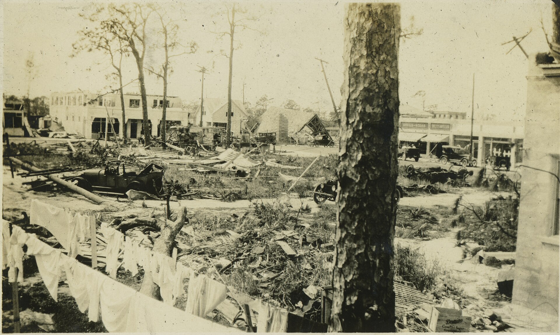
1926, the Great Miami Hurricane
The September 17-18, 1926 storm made landfall at Miami Beach as a Category 4. Brevard, several hundred miles north, took tropical-storm-force winds and approximately 4-7 feet of storm surge in the inlets. Damage in Brevard was modest by the standards of the storm, most of the catastrophic damage hit Miami and the Lake Okeechobee region, but the storm collapsed the brief 1920s Brevard real estate boom and triggered the local end of the Florida land bubble.
1933, the Treasure Coast Hurricane
The September 1933 storm crossed Andros Island, then made landfall near Jupiter Inlet on September 4 as a Category 3. Brevard was in the eastern eye-wall region. Cocoa Beach and Eau Gallie reported winds estimated at 95-110 mph. The Indian River Hotel in Rockledge lost its roof. The wooden Cocoa Beach Pier, then less than 10 years old, was substantially damaged. About 18 deaths were attributed to the storm in Brevard and adjacent counties.
The 1933 storm was largely forgotten in subsequent Florida hurricane discourse because the same season also produced the September 1933 Cuba-Brownsville Hurricane and several other major events. The 1933 Atlantic season remains the most active on record before 2005.
1947, the Fort Lauderdale Hurricane
September 17, 1947. Category 4 at landfall near Pompano Beach. Brevard was on the weak side of the storm and took winds estimated at 70-85 mph plus storm surge of 4-6 feet at the inlets. The Banana River causeway suffered washout damage. The Patrick AFB airfield, then just two years past being a Navy seaplane base, was flooded but not seriously damaged.
The 1947 storm is mostly remembered in Brevard for its meteorological track, it threaded the needle between Patrick and the Cape, missing both substantially despite tracking very close offshore. NAS Banana River, in its last months as a Navy base before being placed in caretaker status, was lightly damaged.
The quiet decades, 1948-1978
Brevard had a relatively storm-light run from 1948 through 1978. The 1950 Hurricane King passed offshore. The 1956 Hurricane Flossy crossed central Florida but as a tropical storm by the time it reached Brevard. Hurricane Donna in 1960, a major storm, tracked west of Brevard and produced winds in the 60-75 mph range locally. Hurricane Cleo in 1964 took a similar track.
The space-program buildout from 1958 to 1972 happened during this relatively benign hurricane period. Many of the buildings, particularly the early Kennedy Space Center facilities and the Cocoa Beach motel district, were built to wind specifications that would prove inadequate when the next major storm hit.
1979, Hurricane David
September 3-4, 1979. David had been a Category 5 over the Caribbean, then weakened to Category 2 by Florida landfall. The storm tracked just east of Brevard, with the center crossing the coast near West Palm Beach. Brevard saw sustained winds of 80-95 mph, gusts to 115 mph at Patrick AFB. Storm surge at the inlets reached 4-7 feet. Power outages county-wide ran 5-7 days. Approximately $40 million in 1979-dollar damage in Brevard, with the heaviest impact in Cocoa Beach, Cape Canaveral, and on the barrier-island properties built during the post-1960 boom.
David exposed the wind-rating problem in the Brevard residential building stock. The state revised the Florida Building Code substantially after the 1992 Hurricane Andrew disaster south of Brevard, but the 1979-era inadequacy of barrier-island building remained until major rebuilding rounds in the 1990s and 2000s.

2004, Frances and Jeanne, three weeks apart
The 2004 Atlantic hurricane season produced four major Florida hurricane events. Two of them hit Brevard directly:
Hurricane Frances, September 4-5, 2004. Category 2 at landfall near Sewall’s Point, just south of Brevard. The slow forward motion (about 5 mph through Florida) meant prolonged exposure. Brevard saw sustained winds of 95-105 mph, gusts to 125 mph at Patrick. Rainfall ran 8 to 14 inches countywide. Storm surge at the inlets reached 5-8 feet.
Hurricane Jeanne, September 26, 2004. Category 3 at landfall at approximately the same location, three weeks after Frances. Brevard saw winds of 105-115 mph sustained, gusts to 130 mph. Rainfall ran 6 to 10 inches on saturated ground.
The combined Frances-Jeanne impact was the single worst hurricane event in Brevard history by economic damage. Total damage in the county exceeded $1.5 billion in 2004 dollars. Approximately 60,000 residential structures sustained damage. Power was out for most of the county for 10 to 14 days. The barrier-island municipalities, Cocoa Beach, Cape Canaveral, Indialantic, Melbourne Beach, Indian Harbour Beach, were essentially uninhabitable for a month. Kennedy Space Center suffered substantial damage to the Vehicle Assembly Building, the Orbiter Processing Facilities, and the launch pads. The Shuttle program lost roughly six months in repair and re-certification work.
The 2004 events drove the major insurance market shift in coastal Florida that continues today. Several major carriers withdrew from the Florida homeowners market. The Citizens Property Insurance Corporation (the state insurer of last resort) absorbed hundreds of thousands of newly uninsurable Brevard policies. Insurance premiums in Brevard tripled between 2004 and 2010 for many coastal properties.
2016, Hurricane Matthew
October 6-7, 2016. Matthew was a Category 4 hurricane that tracked along the Florida east coast about 30 to 50 miles offshore, never making formal landfall. Brevard was in the eastern eye-wall band. Sustained winds reached 95-105 mph at Patrick, gusts to 130 mph at Cape Canaveral. Storm surge at the inlets ran 4-6 feet.
Matthew was a near-miss that could have been catastrophic, a 30-mile shift westward would have produced landfall winds in the Category 4 range in Brevard, comparable to or worse than the 2004 events. As it happened, the damage was substantial but localized: heavy beach erosion, barrier-island roof damage, downed trees and powerlines, three confirmed deaths in Brevard.
2017, Hurricane Irma
September 10-11, 2017. Irma made landfall in the Florida Keys as Category 4 and tracked up the spine of the peninsula. Brevard, on the eastern side of the track, saw winds of 65-85 mph and 6 to 10 inches of rain. Damage was modest by the standards of recent storms. Power was out for 3-5 days for most of the county.
2022, Hurricane Ian and Hurricane Nicole
September 28-29, 2022. Ian made landfall on Florida’s Gulf coast as Category 4, crossed the peninsula, and re-emerged off Brevard as a tropical storm. Local impact was minor.
November 9-10, 2022. Nicole, a Category 1 hurricane at landfall near Vero Beach, hit Brevard with sustained winds of 60-75 mph. The damage was modest by wind standards but the storm caused major beach erosion, accelerating a trend that had been building for years. The Cocoa Beach Pier required substantial structural repair.
What’s the pattern
Brevard takes a major hurricane event roughly every 10 to 15 years, with a notable cluster in the 1947-1964 period and the 2004-2017 period separated by the quieter 1965-2003 decades. Climate analysis suggests Atlantic hurricane activity follows roughly 30-year cycles correlated with the Atlantic Multidecadal Oscillation. The current AMO warm phase, which began around 1995, is the same phase that produced the 1947-1964 active period.
The building stock has been substantially upgraded since the 2004 events. New construction in Brevard since roughly 2007 is built to wind specifications well above the 1970s standards. Older structures, particularly on the barrier islands, remain the largest insurance risk.
What hasn’t changed is the geography. The barrier islands are flat, narrow, and low. The Indian River Lagoon will store storm surge until the inlets and causeways can drain it, which can take days. Cocoa Beach and Cape Canaveral, at 5 to 10 feet of elevation, will flood in any Category 2-or-stronger landfall in the immediate region.
The 1947 storm that grazed Brevard was the last “near miss” of its era. The 2004 storms were the wake-up call for the modern era. The next one is on the books somewhere. Atlantic hurricane records since 1851 suggest Brevard will see another major hit by 2035 at the latest. The infrastructure question for the county is whether the 2024 building stock will hold up better than the 1979 stock did when David came through.
Further Reading
As an Amazon Associate we earn from qualifying purchases.