The Banana River Causeway Story
Five bridges and causeways connect mainland Brevard to the barrier islands. Each one was built to solve a specific problem and each one rewired the local economy as soon as it opened.
Five causeways and bridges connect the Brevard mainland to the barrier islands. Each one was a single political and engineering decision that reshaped local geography within a year or two of opening. Roughly in north-to-south order:
- Max Brewer Bridge / Memorial Parkway at Titusville, opening originally as a fixed wooden span in 1928, replaced multiple times since (current version 2010-2011)
- NASA Causeway across the Indian River and Merritt Island, built 1964 to serve Kennedy Space Center
- State Road 528 / Bennett Causeway at Cocoa, completed in stages 1959-1976
- State Road 520 / Merritt Island Causeway at Cocoa, the busy primary route, original bridge 1917, rebuilt repeatedly
- State Road A1A / Indialantic-Melbourne Causeway at Melbourne, 1923 original
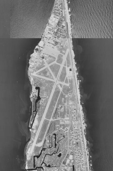
The barrier-island side of Brevard had been essentially unsettled before the first causeways. The 1917 Cocoa causeway (SR 520) opened Merritt Island and Cocoa Beach to development for the first time.
The 1917 SR 520 causeway
The Merritt Island Causeway opened in November 1917 as a wooden trestle bridge crossing the Indian River from Cocoa to Merritt Island, with a separate wooden span across the Banana River from Merritt Island to what is now Cocoa Beach. Total construction cost was approximately $300,000 in 1917 dollars, funded by a combination of Brevard County bonds and state aid.
Before 1917, the only way to reach the barrier islands was by ferry or private boat. The barrier-island population in 1910 was effectively zero. Cocoa Beach had a couple of fishing camps. The original 1917 bridge enabled the first real residential development on Cocoa Beach, including the first hotel (the Banana River Hotel, opened 1922) and the first municipal incorporation (Cocoa Beach incorporated 1925).
The 1917 wooden trestle was replaced in 1948 with a concrete bridge that included a higher-clearance bascule span for boat traffic. The 1948 bridge was replaced again in 1972 with the current 65-foot-clearance fixed span eliminating the bascule.
The 1923 Melbourne-Indialantic Causeway
The Eau Gallie / Indialantic Causeway opened in November 1923, also a wooden trestle initially, replaced 1948 and again in 1986. The 1923 opening made Indialantic and Melbourne Beach accessible to mainland residents for the first time. The post-causeway development boom in Indialantic, much of the historic district there dates to 1924-1929, followed directly.
The 1928 Titusville bridge
The original Max Brewer Bridge in Titusville opened in 1928, named for a Brevard County commissioner who championed it through the funding process. The 1928 span was wooden, frequently damaged by storms, and replaced in 1949. The 1949 concrete span was itself replaced by the current 2010-2011 high-level bridge. Titusville’s bridge connection to the barrier-island town of Port St. John (later integrated into the Cocoa/Cape Canaveral barrier-island municipalities) made Titusville the practical gateway to what became Kennedy Space Center.
The NASA Causeway, 1964
The largest causeway project in Brevard’s history was the NASA Causeway, built between 1962 and 1964 to provide access between the mainland and the Kennedy Space Center launch complexes on the north end of Merritt Island. The causeway includes major bridges over the Indian River and the Banana River, plus several smaller fill-and-bridge sections. Total length is approximately 6 miles. Federal funding paid for the entire project; Brevard County contributed only the right-of-way.
The causeway opened for KSC traffic in late 1964 and became the primary spectator viewing area for launches in the Apollo era. The Apollo 11 launch in July 1969 drew approximately 500,000 spectators to the NASA Causeway area, the single largest crowd ever assembled for a space launch.
The causeway is closed to general public traffic except on launch days, when NASA opens a portion of it for spectators with reservations.
The Bee Line and SR 528
The State Road 528 corridor, originally called the “Bee Line Expressway,” was built in stages from 1959 to 1976 to provide a high-speed connection between Orlando International Airport and Port Canaveral. The Bennett Causeway segment crossing the Indian River at Cocoa opened in 1976.
SR 528 fundamentally changed Brevard’s tourism economy. Walt Disney World opened in Orlando in 1971. The Bee Line gave Disney visitors a 50-minute drive to Cocoa Beach and Port Canaveral. Cruise tourism out of Port Canaveral, which had been a marginal port operation, grew explosively after 1980 to become the world’s busiest cruise port by passenger volume by 2010.
What the causeways enabled
The barrier-island side of Brevard was essentially uninhabited in 1910 and held over 60,000 residents by 1970. The growth would not have been possible without the causeway network. Cocoa Beach, Cape Canaveral, Satellite Beach, Indialantic, Melbourne Beach, Indian Harbour Beach, all of these municipalities exist because the bridges were built.
The same causeway network creates the county’s specific vulnerability to hurricanes. Storm surge in the Indian River can isolate the barrier islands for days when bridges close to traffic. The 2004 hurricanes Frances and Jeanne both required multi-day causeway closures. Hurricane Matthew in 2016 similarly cut the barrier islands off. Evacuation planning relies on the same bridges. When a major hurricane approaches, Brevard’s barrier-island population, over 80,000 people in 2024, has to evacuate over the same five causeways that brought them to the islands in the first place.
The causeways also affected lagoon water flow. Each span constricts tidal exchange, contributing to the chronic water-quality problems in the Banana River and the Indian River. Modeling done by the Florida Inland Navigation District and the St. Johns River Water Management District since 1990 has consistently shown that the causeways’ bridges and fill embankments meaningfully reduce flushing and contribute to the lagoon’s accumulating nutrient load.
The next major causeway project on the table is a possible high-level replacement of the 520 causeway in Cocoa, currently the most heavily trafficked of the five. The bridge dates to 1972 and is functionally obsolete for the 65,000 daily vehicle count it now carries. Whether the project will proceed depends on FDOT funding cycles and on the politics of replacing infrastructure that, for all its limitations, has been the connective tissue of Brevard’s barrier-island economy for over a century.
The cruise industry that SR 528 created
The Bee Line’s role in Brevard’s economy is bigger than the commuter and tourist flow it carries. The corridor made Port Canaveral a global cruise hub. The port had handled marginal cargo and a small cruise operation from 1964 (the SS Yarmouth Castle was the first cruise ship to homeport there) but the operation effectively froze after Yarmouth Castle burned at sea on November 13, 1965, killing 90 passengers. Cruise traffic through Port Canaveral barely existed for the next fifteen years.
The change came in 1982. Port director Charles Rowland converted a 20,000 square foot cargo warehouse into the port’s first cruise terminal and signed Premier Cruise Line’s Scandinavian Sea as the first homeported ship. The cruise growth from that point tracked almost exactly with Walt Disney World attendance and with SR 528 traffic. By 2010 Port Canaveral was handling roughly 2.8 million cruise passengers per year. By 2025 the port reported over 8.6 million revenue passenger movements, making it the busiest cruise port in the world.
None of that growth would have happened without the SR 528 connection. The port’s geographic position, a 50-minute drive from Orlando International, is the entire competitive advantage over Miami and Fort Lauderdale, which are both closer to a major airport but require a 3-hour drive from Orlando through the worst Florida turnpike traffic. The Bennett Causeway segment opening in 1976 closed the loop between Walt Disney World (1971), the cruise port (1982 effective relaunch), and the Cocoa Beach tourism economy that the 1917 SR 520 causeway had originally enabled.
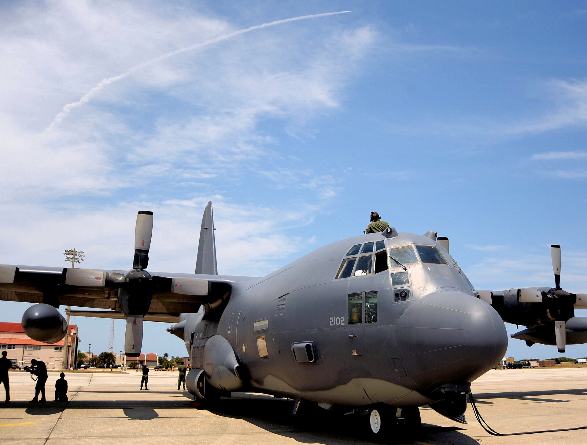
The NAS Banana River foundation
The federal investment that paid for most of the postwar causeway upgrades had its origin in a single 1948 transfer. The Navy ran a seaplane patrol base on the south end of the Banana River through World War II under the name Naval Air Station Banana River, commissioned for anti-submarine warfare. In June 1948 the Navy handed the facility over to the Air Force. The Air Force renamed it the Joint Long Range Proving Ground in June 1949, then Patrick Air Force Base on May 17, 1950 in honor of Major General Mason Patrick. That handoff made the entire Banana River corridor a federally significant transportation route.
Every Banana River causeway upgrade after 1950, the 1948 SR 520 concrete replacement, the 1949 Titusville bridge replacement, the 1964 NASA Causeway, the 1972 SR 520 fixed-span replacement, drew at least partial federal funding under defense-readiness or NASA-access justifications. Without Patrick AFB and KSC on the federal property at the north end of the corridor, the bridges would have stayed as the state and county could afford on tourism tax receipts alone. The federal payroll on the barrier islands rewrote what was possible.
Further Reading
As an Amazon Associate we earn from qualifying purchases.